Home / Garden Blog / Eight Decades of Change in Two Photographs of Corona del Mar
Eight Decades of Change in Two Photographs of Corona del Mar
Paul Wormser, Library Director
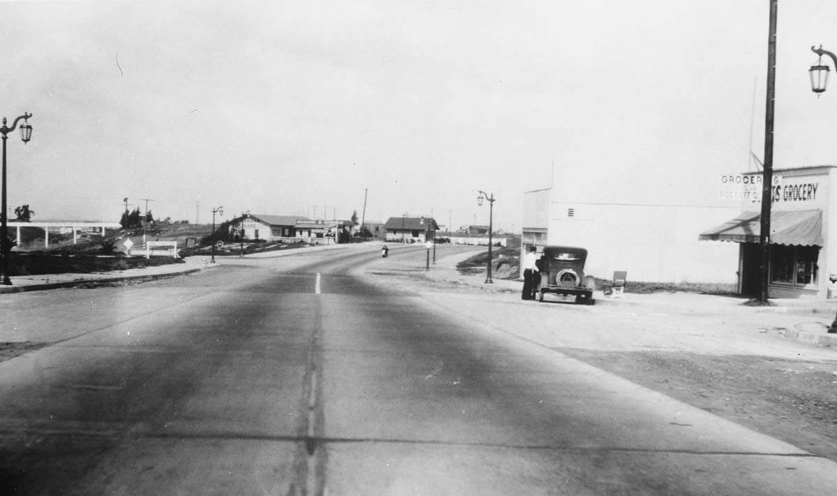
At first glance, this photograph may seem uninteresting. It is after all, a shot of a nearly empty street with a few buildings. If you look closely, you will see a number of clues to the location and date. To the left, you can see the Goldenrod footbridge and to the right a grocery store, which also served as a post office. The store was Scott’s Grocery, which city directories indicate was on the corner of Coast Highway and Marigold Ave. In the distance toward the center of the photo, you will notice two additional buildings. The nearer of the two, on the left, was Brigg’s Service Station, and the smaller building in the distance was the K. I. Fulton real estate office.
The photograph is undated. However, some elements help us to pinpoint the probable year as 1932. First, are the facts that Coast Highway was opened through Corona del Mar in 1926 and the Goldenrod footbridge was completed in 1928. So, the photograph has to be dated after 1928. Samuel Scott, the grocery store owner, was also the Corona del Mar Postmaster from 1927 to 1934, when he sold his business and moved out of the area. This means the photograph was taken no later than 1934. The final clue is more difficult to discern. If you look to the right of the Fulton real estate office, you can see a white fence across coast highway. Even though it was only six years old, in 1932 the State of California began widening Coast Highway between Newport Beach and Dana Point. It seems likely that this photograph was taken in 1932, when parts of Coast Highway were temporarily closed while the road was widened.
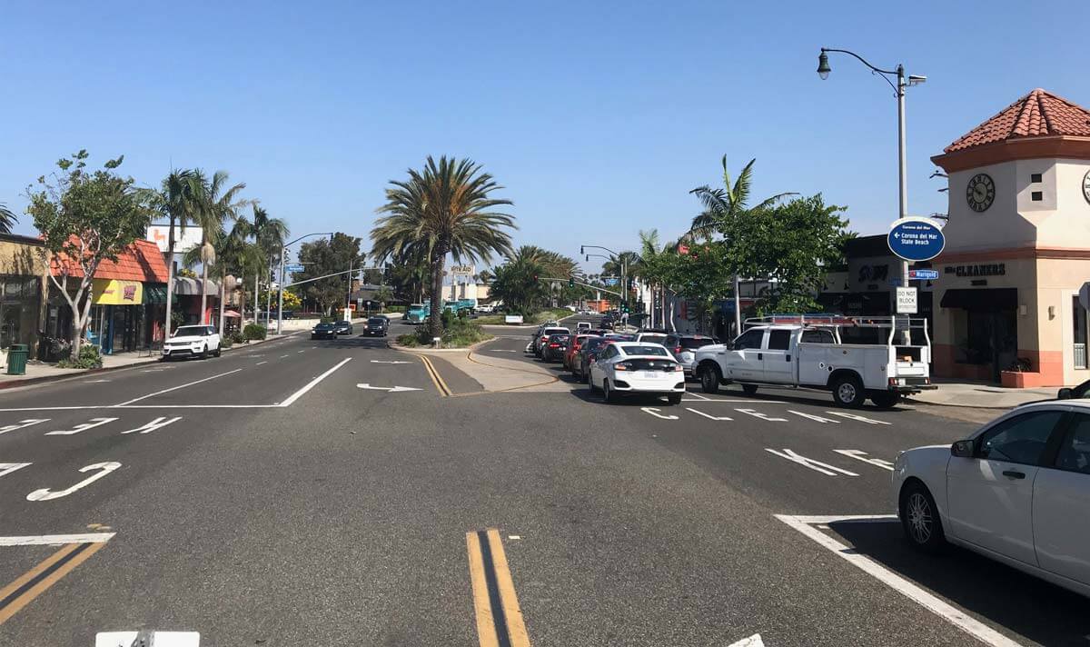
This contemporary photograph was taken from the same spot as the original, the median of Coast Highway, looking toward the intersection at Marguerite Ave. Scott’s grocery is long gone, replaced by a dry cleaner. The footbridge is no longer visible, the line of sight being blocked by businesses. The service station was roughly where the Rite Aid is now. In the time since the first photo was taken, Coast Highway has also been widened even more, and medians added.
This animation shows the 1932 photograph dissolving into the 2018 image, and back again. It is a stark demonstration of the changes eight decades have brought to Corona del Mar.